- Main Page
- General Public
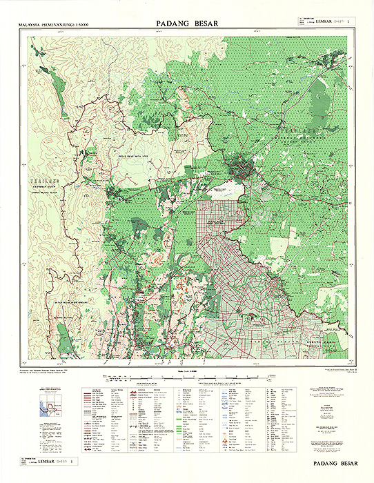
Map Type:
Topographic Map 1:50 000 Peninsular Malaysia – Series No DNMM5101
Description:
Cultural features consist of highways and roads, railways, building and boundaries. Highways and roads can be classified as dual and single, unsealed, footpath and road under construction. Boundaries are shown in hierarchy, starting from international boundary, state, division, district, mukim and reserve. Relief is shown as contour lines with 100 meter interval and heights in meters. Vegetation and cultivations, town and built-up areas shown with specified symbols. Hydrographic features are also shown. Projection used is the Rectified Skew Orthomorphic and Rectified Skew Orthomorphic Grid (meter). This map is produced by digital method.
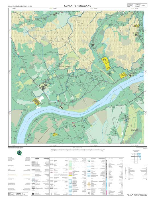
Map Type:
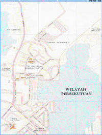
Peta Topografi 1:3000 – 12 500 Town Map in Peninsular Malaysia – Series No DNMM8101
Description:
Cultural features consist of roads, railways, features related to roads and railways, building, thematic symbols, other cultural and miscellaneous construction and boundaries. Roads are classified as through route, dual and single carriageway, unsealed surface, road under construction and motorable track and are annotate. Buildings are annotate with their respective names and shown with thematic symbols where applicable. Boundaries are shown in hierarchy, starting from international boundary, state, division, district, mukim and reserve. Relief is shown as contour lines with 25 meter interval and heights in meters. Vegetation and cultivations, and area classification are shown with specified symbols. Hydrographic features are also shown. Projection used is the Rectified Skew Orthomorphic and Rectified Skew Orthomorphic Grid (metres). This map is produced by digital method.
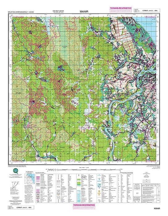
Map Type:
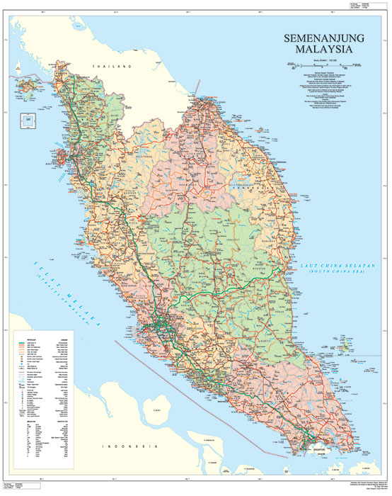
PETA TOPOGRAFI SEMENANJUNG MALAYSIA (SIRI MY502A)
Description:
Peta Topografi Tidak Terhad berskala 1:50,000 merupakan peta yang meliputi kawasan seluruh Semenanjung Malaysia. Peta ini diterbitkan bagi kegunaan awam berdasarkan spesifikasi yang telah ditetapkan merangkumi ciri-ciri seperti rupa muka bumi semulajadi, ciri-ciri buatan, hidrografi, hypsografi, demarcation dan relief beserta anotasi. Peta ini disusun di atas Unjuran Bentuk Benar Serong Ditepati (Semenanjung Malaysia) Sferoid GRS 80, Datum 2000
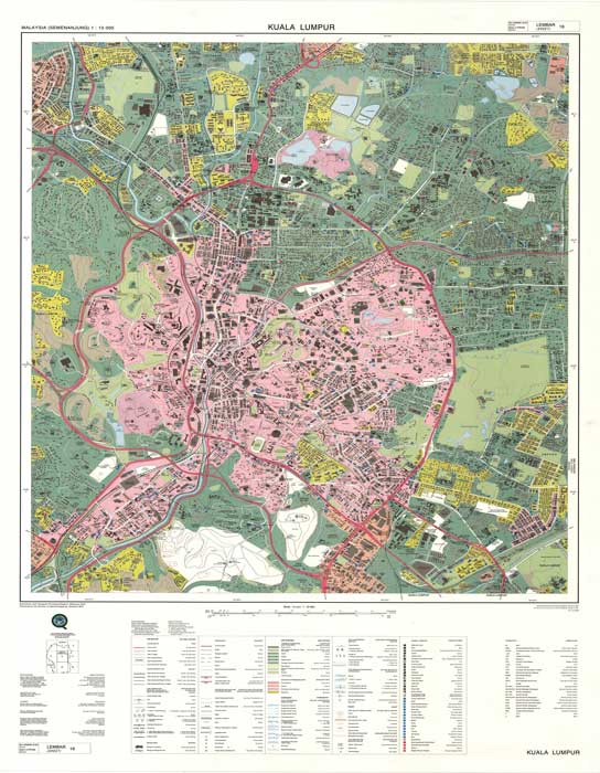
Map Type:
Topographic Map 1:10 000 Klang Valley- No. Siri DNMM6101
Description:
Description Cultural features consist of roads, railways, features related to roads and railways, building, thematic symbols, other cultural and miscellaneous construction and boundaries. Roads are classified as through route, dual and single carriageway, unsealed surface, road under construction and motorable track and are annotate. Buildings are annotate with their respective names and shown with thematic symbols where applicable. Boundaries are shown in hierarchy, starting from international boundary, state, division, district, mukim and reserve. Relief is shown as contour lines with 25 meter interval and heights in meters. Vegetation and cultivations, and area classification are shown with specified symbols. Hydrographic features are also shown. Projection used is the Rectified Skew Orthomorphic and Rectified Skew Orthomorphic Grid (meter). This map is produced by digital method.
Map Type:
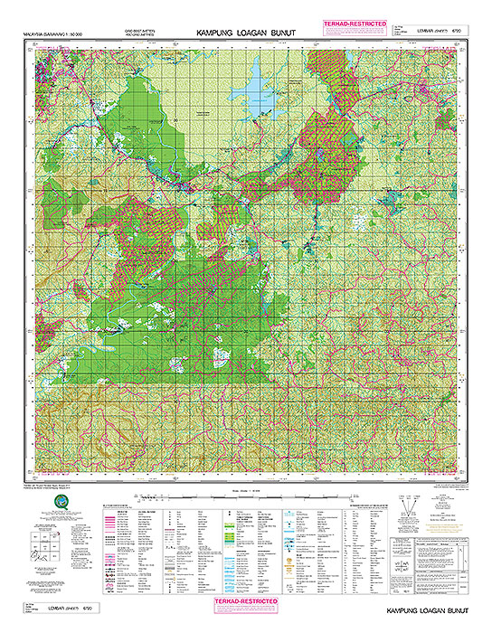
Topographic Map 1:50 000 Sabah & Sarawak – Series No DNMM5201
Description:
Cultural features consist of highways and roads, railways, building and boundaries. Highways and roads can be classified as dual and single, unsealed, footpath and road under construction. Boundaries are shown in hierarchy, starting from international boundary, state, division, district, mukim and reserve. Relief is shown as contour lines with 100 meter interval and heights in meters. Vegetation and cultivations, town and built-up areas shown with specified symbols. Hydrographic features are also shown. Projection used is the Borneo Rectified Skew Orthomorphic and Borneo Rectified Skew Orthomorphic Grid (meter). This map is produced by digital method.
Map Type:
PETA TOPOGRAFI SEMENANJUNG (SIRI L7030)
Description:
Features shown include highway and road, railway, building and boundaries. Highways and roads are classified as dual or single carriage, unsealed, footpath and road under construction. Boundaries are shown in hierarchy, starting from international boundary, state, division, district, mukimand reserve. Relief is shown as contour lines with 20 meter interval and heights in meters. Vegetation and cultivations, town and built-up areas shown with specified symbols. Hydrographic features are also shown. Projection used is the Rectified Skew Orthomorphic and Rectified Skew Orthomorphic Grid (meter).
Map Type:
Restricted Topographic Map1:3000 – 12 500 Town Map in Peninsular Malaysia – Series No L905
Description:
Cultural features consist of roads, railways, features related to roads and railways, building, thematic symbols, other cultural and miscellaneous construction and boundaries. Roads are classified as through route, dual and single carriageway, unsealed surface, road under construction and motor able track and are annotated. Buildings are annotate with their respective names and shown with thematic symbols where applicable. Boundaries are shown in hierarchy, starting from international boundary, state, division, district,mukim and reserve. Relief is shown as contour lines with 5 meter interval and heights in meters. Vegetation and cultivations, and area classification are shown with specified symbols. Hydrographic features are also shown. Projection used is the Rectified Skew Orthomorphic and Rectified Skew Orthomorphic Grid (meter). This map is produce by digital method.
Map Type:
PETA TOPOGRAFI SEMENANJUNG MALAYSIA (SIRI MY701T (10K)) & (SIRI MY701T (5K))
Description:
Peta Topografi Terhad berskala 1:10 000 & 1:5 000 merupakan peta yang meliputi kawasan seluruh Semenanjung Malaysia. Peta ini diterbitkan bagi kegunaan awam berdasarkan spesifikasi yang telah ditetapkan merangkumi ciri-ciri seperti rupa muka bumi semulajadi, ciri-ciri buatan, hidrografi, hypsografi, demarcation dan relief beserta anotasi. Peta ini disusun di atas Unjuran Bentuk Benar Serong Ditepati (Semenanjung Malaysia) Sferoid GRS 80, Datum 2000
Map Type:
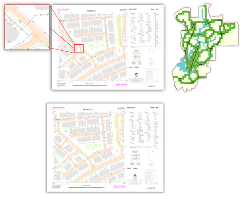
Restricted Utility Map 1:500 For Putrajaya – Series No MY901U
Description:
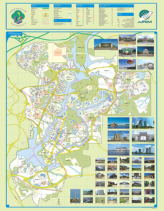
Utilities feature consist of underground installation lines for electricity distribution, telecommunication cables, natural gas pipes, water mains and sewerage pipes. Meanwhile, cultural features consist of boundaries, cadastral land parcels, buildings, transportation, hydrography, public facilities and others. Projection used is the Rectified Skew Orthomorphic (RSO) based on Geocentric Datum of Malaysia 2000 (GDM2000). This map is produce by digital method.
Map Type:
Restricted Topographic Map 1:10 000 Klang Valley- Series No. L808
Description:
Cultural features consist of roads, railways, features related to roads and railways, building, thematic symbols, other cultural and miscellaneous construction and boundaries. Roads are classified as through route, dual and single carriageway, unsealed surface, road under construction and motorable track and are annotated. Buildings are annotate with their respective names and shown with thematic symbols where applicable. Boundaries are shown in hierarchy, starting from international boundary, state, division, district, mukim and reserve. Relief is shown as contour lines with 5 meter interval and heights in meters. Vegetation and cultivations, and area classification are shown with specified symbols. Hydrographic features are also shown. Projection used is the Rectified Skew Orthomorphic and Rectified Skew Orthomorphic Grid (meter). This map is produce by digital method.
Map Type:
Restricted Topographic Map 1:50 000 Sabah & Sarawak – Series No T738
Description:
Cultural features consist of highways and roads, railways, building and boundaries. Highways and roads can be classified as dual and single, unsealed, footpath and road under construction. Boundaries are shown in hierarchy, starting from international boundary, state, division, district, mukim and reserve. Relief is shown as contour lines with 20 meter interval and heights in meters. Vegetation and cultivations, town and built-up areas shown with specified symbols. Hydrographic features are also shown. Projection used is the Borneo Rectified Skew Orthomorphic and UTM Grid (meter). This map is produced by digital method.
Map Type:
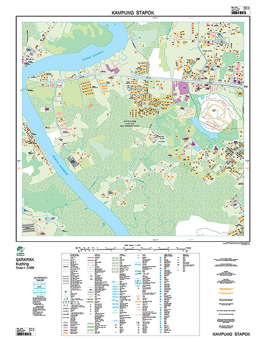
Restricted Topographic Map 1:3000 – 12 500 for Sabah & Sarawak – No. Siri T931
Description:
Cultural features consist of roads, railways, features related to roads and railways, building, thematic symbols, other cultural and miscellaneous construction and boundaries. Roads are classified as through route, dual and single carriageway, unsealed surface, road under construction and motorable track and are annotate. Buildings are annotate with their respective names and shown with thematic symbols where applicable. Boundaries are shown in hierarchy, starting from international boundary, state, division, district, mukim and reserve. Relief is shown as contour lines with 5 meter interval and heights in meters. Vegetation and cultivations, and area classification are shown with specified symbols. Hydrographic features are also shown. Projection used is the Borneo Rectified Skew Orthomorphic and Borneo Rectified Skew Orthomorphic Grid (meter). This map is produced by digital method.
Map Type:
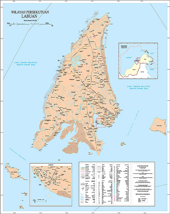
PETA TOPOGRAFI SABAH, SARAWAK & WP LABUAN (SIRI MY711T (10K)) & (SIRI MY711T (5K))
Description:
Peta Topografi Terhad berskala 1:10 000 & 1:5 000 merupakan peta yang meliputi kawasan seluruh Sabah & Sarawak. Peta ini diterbitkan bagi kegunaan awam berdasarkan spesifikasi yang telah ditetapkan merangkumi ciri-ciri seperti rupa muka bumi semulajadi, ciri-ciri buatan, hidrografi, hypsografi, demarcation dan relief beserta anotasi. Peta ini disusun di atas Unjuran Bentuk Benar Serong Ditepati (Sabah, Sarawak dan Wilayah Persekutuan Labuan) Sferoid GRS 80, Datum 2000
Jenis Peta:
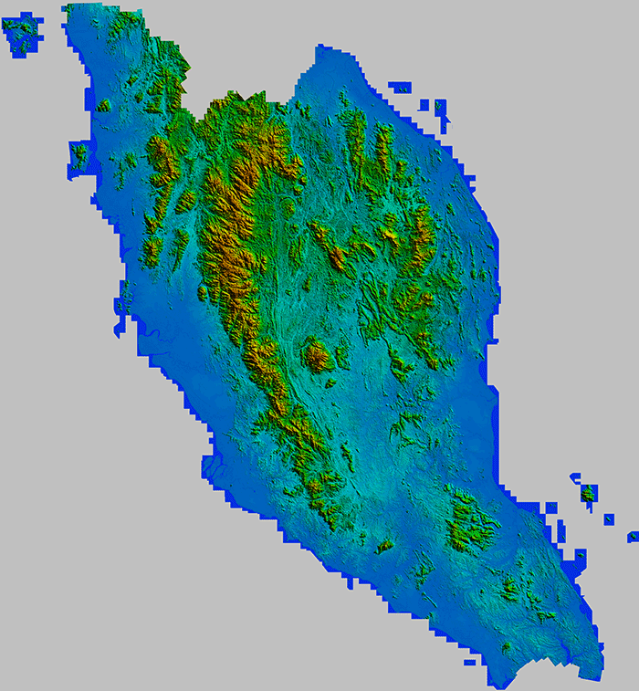
DTM SEMENANJUNG MALAYSIA (SIRI DTM_MY501T - 2008)
Keterangan:
Peta Topografi Terhad berskala 1:50 000 merupakan peta yang meliputi kawasan seluruh Semenanjung Malaysia. Peta ini diterbitkan bagi kegunaan awam berdasarkan spesifikasi yang telah ditetapkan merangkumi ciri-ciri seperti rupa muka bumi semulajadi, ciri-ciri buatan, hidrografi, hypsografi, demarcation dan relief beserta anotasi. Butiran-butiran buatan yang ditunjukkan adalah termasuk lebuhraya dan jalan raya, jalan kereta api, bangunan dan sempadan. Lebuhraya dan Jalan Raya dikelaskan kepada berkembar atau tunggal, tidak berturap, laluan pejalan kaki dan jalan sedang dibina. Sempadan ditunjukkan mengikut keutamaan dimulakan dengan sempadan antarabangsa, negeri, bahagian, daerah, mukim dan rizab. Relief digambarkan dengan garis kontur berskala 20 meter dan ukur ketinggian dalam meter. Tumbuhan dan tanaman, bandar dan kawasan tepubina ditunjukkan dengan simbol tertentu. Ciri hidrografi juga ditunjukkan. Peta ini telah disusun di atas Unjuran Bentuk Benar Serong Ditepati Malaya
Jenis Peta:
DTM SEMENANJUNG MALAYSIA (SIRI DTM_MY501T - 2017)
Keterangan:
Model Rupa Bumi Digital (DTM) Semenanjung Malaysia. JUPEM membekal data model rupa bumi digital (DTM) tahun 2017 yang terdiri daripada ketinggian rupa bumi bagi kedudukan tanah pada sela ufuk setiap 10 meter. Produk rupa bumi digital boleh digunakan dalam penjanaan grafik tiga dimensi yang memaparkan kecerunan rupa bentuk bumi, aspek (arah kecerunan) dan profil rupa bentuk bumi di antara titik-titik yang dipilih. Peta ini telah disusun di atas Unjuran Bentuk Benar Serong Ditepati Malaya
Jenis Peta:
DSM SEMENANJUNG MALAYSIA (SIRI DSM_MY501T - 2008)
Keterangan:
Model Permukaan Berdigit Semenanjung Malaysia. JUPEM membekal data model permukaan berdigit (DSM) tahun 2008 yang terdiri daripada ketinggian rupa bumi bagi kedudukan tanah pada sela ufuk setiap 10 meter. Produk rupa bumi digital boleh digunakan dalam penjanaan grafik tiga dimensi yang memaparkan kecerunan rupa bentuk bumi, aspek (arah kecerunan) dan profil rupa bentuk bumi di antara titik-titik yang dipilih. Peta ini telah disusun di atas Unjuran Bentuk Benar Serong Ditepati Malaya
Jenis Peta:
DSM SEMENANJUNG MALAYSIA (SIRI DSM_MY501T - 2017)
Keterangan:
Model Permukaan Berdigit Semenanjung Malaysia. JUPEM membekal data model permukaan berdigit (DSM) tahun 2017 yang terdiri daripada ketinggian rupa bumi bagi kedudukan tanah pada sela ufuk setiap 10 meter. Produk rupa bumi digital boleh digunakan dalam penjanaan grafik tiga dimensi yang memaparkan kecerunan rupa bentuk bumi, aspek (arah kecerunan) dan profil rupa bentuk bumi di antara titik-titik yang dipilih. Peta ini telah disusun di atas Unjuran Bentuk Benar Serong Ditepati Malaya
Jenis Peta:
DTM SABAH DAN SARAWAK (SIRI DTM_MY511T)
Keterangan:
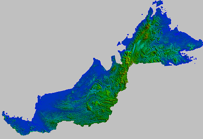
Model Rupa Bumi Digital (DTM) Sabah & Sarawak. JUPEM membekal data model rupa bumi digital (DTM) tahun 2008 yang terdiri daripada ketinggian rupa bumi bagi kedudukan tanah pada sela ufuk setiap 10 meter. Produk rupa bumi digital boleh digunakan dalam penjanaan grafik tiga dimensi yang memaparkan kecerunan rupa bentuk bumi, aspek (arah kecerunan) dan profil rupa bentuk bumi di antara titik-titik yang dipilih. Peta ini telah disusun di atas Unjuran Bentuk Benar Serong Ditepati Borneo
Jenis Peta:
DSM SABAH DAN SARAWAK (SIRI DSM_MY511T)
Keterangan:
Peta Topografi Terhad berskala 1:3 000, 1:5 000, 1:7 500, 1:10 000 dan 1:12 500 merupakan peta yang meliputi kawasan seluruh kawasan bandar-bandar di Sabah dan Sarawak. Peta ini diterbitkan bagi kegunaan awam berdasarkan spesifikasi yang telah ditetapkan merangkumi ciri-ciri seperti rupa muka bumi semulajadi, ciri-ciri buatan, hidrografi, hypsografi, demarcation dan relief beserta anotasi. Ciri-ciri yang ditunjukkan adalah sempadan antarabangsa, negeri, bahagian, daerah, daerah kecil, dan rizab. Relief digambarkan dengan garis kontur berjarak 5 meter. Ukur tinggi dalam ukuran meter. Jalan dikelaskan kepada jalan terus, jalan kembar, jalan tunggal, berturap dan tidak berturap, lorong boleh berkereta motor dan lorong kaki. Jalan dianotasi, jalan keretapi, bangunan ditunjukkan dengan simbol dan nama-nama tertentu, susunan warna yang membezakan jenis bangunan. Tumbuh-tumbuhan ditunjukkan dengan simbol dan ciri hidrografi juga ditunjukkan. Peta ini telah disusun di atas Unjuran Bentuk Benar Serong Ditepati Borneo
Jenis Peta:
PETA DAERAH SEMENANJUNG (SIRI MY90001R)
Keterangan:
Peta Daerah merupakan peta tematik yang memaparkan maklumat pentadbiran daerah dalam sesebuah negeri. Kawasan pentadbiran seperti daerah/ jajahan, mukim, pekan dan bandar dipersembahkan dalam warna yang berbeza dan dianotasikan. Antara maklumat yang dipaparkan adalah termasuk jalan yang dikelaskan oleh pihak Jabatan Kerja Raya (JKR), jalan keretapi dan sungai. Lain-lain maklumat seperti balai polis, hospital, bangunan kerajaan, sekolah dan kemudahan lain ditunjukkan sebagai simbol tematik mengikut lokasinya. Kawasan penting melibatkan sebahagian ibu daerah ditandakan dengan kotak garisan putus di peta utama dan dibuatkan peta inset dalam skala yang besar. Maklumat jalan, bangunan kediaman dan pentadbiran serta kemudahan lain yang lebih terperinci ditunjukkan dalam bentuk simbol tematik dan dianotasikan. Peta ini disusun di atas Unjuran Bentuk Benar Serong Ditepati (Semenanjung Malaysia) Sferoid GRS 80, Datum 2000
Jenis Peta:
PETA DAERAH SABAH, SARAWAK & WP LABUAN (SIRI MY91001R)
Keterangan:
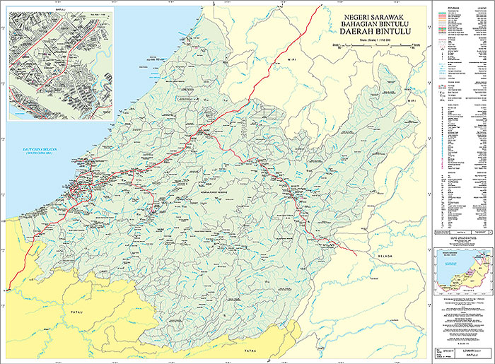
Peta Daerah merupakan peta tematik yang memaparkan maklumat pentadbiran daerah dalam sesebuah negeri. Kawasan pentadbiran seperti bahagian, daerah, daerah kecil, pekan dan bandar dipersembahkan dalam warna yang berbeza dan dianotasikan. Antara maklumat yang dipaparkan adalah termasuk jalan yang dikelaskan oleh pihak Jabatan Kerja Raya (JKR), jalan keretapi dan sungai. Lain-lain maklumat seperti balai polis, hospital, bangunan kerajaan, sekolah dan kemudahan lain ditunjukkan sebagai simbol tematik mengikut lokasinya. Kawasan penting melibatkan sebahagian ibu daerah ditandakan dengan kotak garisan putus di peta utama dan dibuatkan peta inset dalam skala yang besar. Maklumat jalan, bangunan kediaman dan pentadbiran serta kemudahan lain yang lebih terperinci ditunjukkan dalam bentuk simbol tematik dan dianotasikan. Peta ini disusun di atas Unjuran Bentuk Benar Serong Ditepati (Sabah, Sarawak dan Wilayah Persekutuan Labuan) Sferoid GRS 80, Datum 2000
Jenis Peta:
PETA PENGANGKUTAN DI SABAH/SARAWAK/LABUAN (SIRI DNMM9001)
Keterangan:
Peta Pengangkutan merupakan peta tematik yang memaparkan maklumat jalinan pengangkutan darat antara bandar/pekan/kampung dalam sesebuah negeri. Antara maklumat yang dipaparkan adalah termasuk jalan yang dikelaskan oleh pihak Jabatan Kerja Raya (JKR), jalan keretapi dan sungai. Maklumat jarak (dalam kilometer) antara bandar utama, nombor laluan Lebuhraya, Jalan Persekutuan, dan Jalan Negeri turut dipaparkan dalam peta ini.
Jenis Peta:
PETA PENGANGKUTAN NEGERI-NEGERI SEMENANJUNG (SIRI MY90003R)
Keterangan:
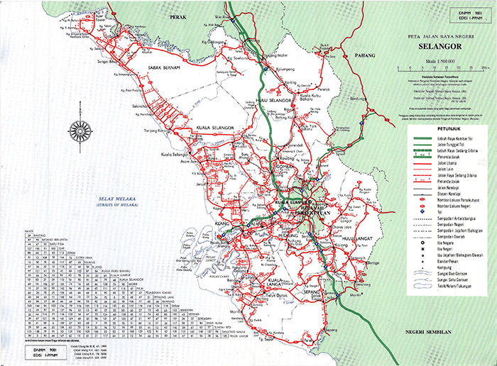
Peta Pengangkutan merupakan peta tematik yang memaparkan maklumat jalinan pengangkutan darat antara bandar/pekan/kampung dalam sesebuah negeri. Antara maklumat yang dipaparkan adalah termasuk jalan yang dikelaskan oleh pihak Jabatan Kerja Raya (JKR), jalan keretapi dan sungai. Maklumat jarak (dalam kilometer) antara bandar utama, nombor laluan Lebuhraya, Jalan Persekutuan, dan Jalan Negeri turut dipaparkan dalam peta ini. Peta ini disusun di atas Unjuran Bentuk Benar Serong Ditepati (Semenanjung Malaysia) Sferoid GRS 80, Datum 2000
Jenis Peta:
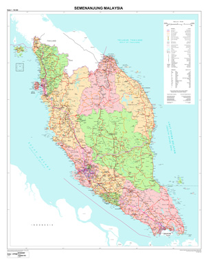
PETA POLITIKAL SEMENANJUNG (SIRI MY90008R)
Keterangan:
Peta Politikal merupakan peta tematik yang memaparkan maklumat kawasan-kawasan pentadbiran setiap negeri. Kawasan pentadbiran negeri dipersembahkan dalam warna yang berbeza dan dianotasikan. Ciri-ciri seperti sempadan antarabangsa, negeri, daerah serta maklumat-maklumat seperti jalan raya, jalan keretapi, sungai, nama bandar dan kampung ditunjukkan mengikut simbol-simbol tertentu.
Saiz format peta adalah seperti berikut:
Lembar 1 : 72 sm x 87.5 sm (Semenanjung Malaysia)
Peta ini disusun di atas Unjuran Bentuk Benar Serong Ditepati (Semenanjung Malaysia) Sferoid GRS 80, Datum 2000
Jenis Peta:
PETA POLITIKAL SABAH DAN SARAWAK (SIRI MY91008R)
Keterangan:
Peta Politikal merupakan peta tematik yang memaparkan maklumat kawasan-kawasan pentadbiran setiap negeri. Kawasan pentadbiran negeri dipersembahkan dalam warna yang berbeza dan dianotasikan. Ciri-ciri seperti sempadan antarabangsa, negeri, bahagian, daerah, daerah kecil serta maklumat-maklumat .seperti jalan raya, jalan keretapi, sungai, nama bandar dan kampung ditunjukkan mengikut simbol-simbol tertentu.
Saiz format peta adalah sperti berikut:
Lembar 2 : 83 sm x 100 sm (Sarawak)
Lembar 3 : 83 sm x 100 sm (Sabah)
Peta ini disusun di atas Unjuran Bentuk Benar Serong Ditepati (Sabah, Sarawak dan Wilayah Persekutuan Labuan) Sferoid GRS 80, Datum 2000
Jenis Peta:
PETA NEGERI SEMENANJUNG (SIRI MY90005R)
Keterangan:
Peta Negeri merupakan peta tematik yang memaparkan maklumat pentadbiran negeri, daerah/ jajahan, dan mukim dipersembahkan dalam warna yang berbeza serta dianotasikan. Antara maklumat yang dipaparkan adalah pengangkutan, pelbagai binaan, hidrografi, sempadan dan status tempat. Peta ini disusun di atas Unjuran Bentuk Benar Serong Ditepati (Semenanjung Malaysia) Sferoid GRS 80, Datum 2000
Jenis Peta:
PETA NEGERI SABAH, SARAWAK & WP LABUAN (SIRI MY91005R)
Keterangan:
Peta Negeri merupakan peta tematik yang memaparkan maklumat pentadbiran negeri, bahagian, daerah dan daerah kecil dipersembahkan dalam warna yang berbeza serta dianotasikan. Antara maklumat yang dipaparkan adalah pengangkutan, pelbagai binaan, hidrografi, sempadan dan status tempat. Peta ini disusun di atas Unjuran Bentuk Benar Serong Ditepati (Sabah, Sarawak dan Wilayah Persekutuan Labuan) Sferoid GRS 80, Datum 2000
Jenis Peta:
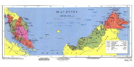
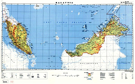
PETA AM MALAYSIA (POLITIKAL) (SIRI MY92001R)
Keterangan:
Peta Am Malaysia merupakan peta tematik yang terdiri daripada Semenanjung Malaysia, Sabah dan Sarawak yang diterbitkan dalam satu lembar. Kawasan-kawasan pentadbiran negeri dipersembahkan dalam warna yang berbeza dan dianotasikan. Maklumat mengenai sempadan antarabangsa, negeri dan jajahan Sabah dan Sarawak ditunjukkan. Ciri-ciri maklumat seperti jalan, jalan keretapi, sungai, nama bandar dan kampung ditunjukkan dengan menggunakan simbol yang tertentu. Peta ini telah disusun di atas Unjuran Kun Mudah
Jenis Peta:
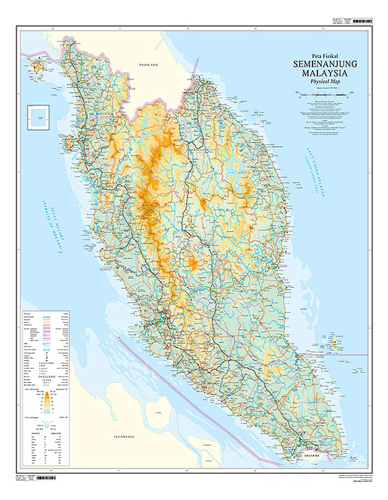
PETA FIZIKAL SEMENANJUNG (SIRI MY90006R)
Keterangan:
Peta jenis fizikal berwarna yang menunjukkan relief dalam bentuk lapisan tinta. Ciri-ciri sempadan seperti antarabangsa, negeri dan daerah ditunjukkan. Maklumat seperti jalan, keretapi, sungai, nama bandar, pekan dan kampung ditunjukkan menggunakan simbol tertentu. Peta ini disusun di atas Unjuran Bentuk Benar Serong Ditepati (Semenanjung Malaysia) Sferoid GRS 80, Datum 2000
Jenis Peta:
PETA NEGERI (SIRI DNMM9101)
Keterangan:
Peta jenis politikal (pentadbiran) berwarna bagi setiap negeri di Malaysia. Peta-peta yang diterbitkan menunjukkan perbezaan warna untuk setiap daerah kecuali Perlis dan Wilayah Persekutuan Kuala Lumpur yang ditunjuk dengan perbezaan warna untuk mukim. Negeri-negeri yang besar seperti Johor, Pahang, Selangor, Perak, dan Kedah peta ini dicetak kepada dua (2) lembar peta. Ciri-ciri seperti sempadan antarabangsa, negeri, daerah dan mukim ditunjukkan. Perbezaan warna ditunjukkan bagi setiap daerah di negeri berkenaan. Maklumat-maklumat seperti jalan raya dikelaskan mengikut hirarki kepentingan, jalan keretapi, sungai, nama bandar dan kampung ditunjukkan mengikut simbol-simbol tertentu.
Jenis Peta:
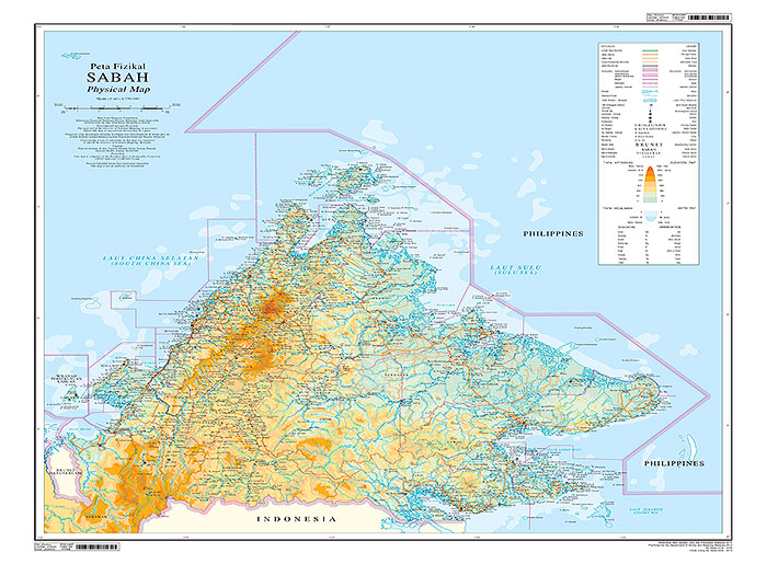
PETA FIZIKAL SABAH & SARAWAK (SIRI MY91006R)
Keterangan:
Peta jenis fizikal berwarna yang menunjukkan relief dalam bentuk lapisan tinta. Ciri-ciri sempadan seperti antarabangsa, negeri dan bahagian ditunjukkan. Maklumat seperti jalan, keretapi, sungai, nama bandar, pekan dan kampung ditunjukkan menggunakan simbol tertentu. Peta ini disusun di atas Unjuran Bentuk Benar Serong Ditepati (Sabah, Sarawak dan Wilayah Persekutuan Labuan) Sferoid GRS 80, Datum 2000
Jenis Peta:
Peta Laporan Malaysia (1:4,500,000) – No. Siri Malaysia Report Map
Pengenalan:
Peta jenis politikal (pentadbiran) berwarna yang meliputi kawasan Semenanjung Malaysia, Sabah dan Sarawak.
Keterangan:
Ciri-ciri seperti sempadan antarabangsa, sempadan negeri ditunjukkan mengikut simbol-simbol tertentu. Walaubagaimanapun maklumat -maklumat yang terdapat di peta ini adalah maklumat lama dan tidak dikemaskini.
Jenis Peta:
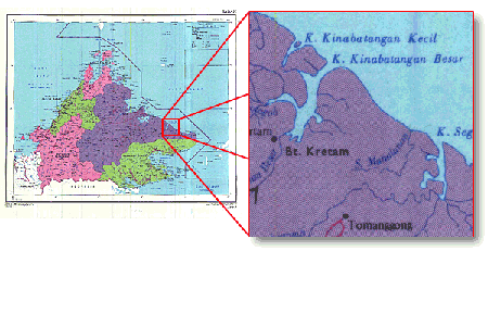
Peta Laporan Sabah (1:1 250 000) – No. Siri Rampaian 80
Pengenalan:
Peta politikal (pentadbiran) berwarna yang meliputi kawasan Negeri Sabah.
Keterangan:
Ciri-ciri maklumat seperti sempadan bahagian, negeri dan antarabangsa ditunjukkan. Maklumat di peta ini tidak dikemaskini dan penerbitannya telah dihentikan.
Jenis Peta:
Peta Sabah (1: 500 000) – No. Siri Rampaian 37
Pengenalan:
Peta jenis fizikal yang menunjukkan kawasan rupa muka bumi dengan susunan warna yang membezakan tinggi relief.
Keterangan:
Ciri-ciri seperti sempadan antarabangsa, negeri, daerah serta maklumat-maklumat seperti jalan raya, jalan keretapi, sungai, nama bandar dan kampung ditunjukkan mengikut simbol-simbol tertentu.
Jenis Peta:
Peta Politikal Malaysia (1:760 000) – No. Siri Rampaian 45
Pengenalan:
Peta jenis politikal (pentadbiran) yang berwarna penuh yang menunjukkan perbezaan warna bagi setiap negeri dan digantikan dengan Siri DNMM 2001 pada skala 1:750 000.
Keterangan:
Ciri-ciri seperti sempadan antarabangsa, negeri , daerah serta maklumat-maklumat seperti jalan raya, jalan keretapi, sungai , nama bandar dan kampung ditunjukkan mengikut simbol-simbol tertentu.
Jenis Peta:
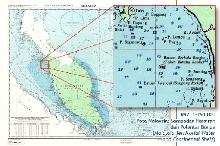
Peta Sempadan Perairan Pelantar Benua Malaysia (1:1 500 000) – No. Siri Rampaian 97
Pengenalan:
Peta yang menunjukkan sempadan perairan dan pelantar benua bagi Semenanjung Malaysia, Sabah dan Sarawak.
Keterangan:
Ciri-ciri maklumat seperti titik kedalaman, kordinit sempadan pelantar benua, sempadan antarabangsa, sempadan perairan wilayah ditunjukkan dengan menggunakan warna dan simbol yang tertentu.
Jenis Peta:
Peta Jalanraya Negeri-Negeri Semenanjung Malaysia
Pengenalan:
Peta Jalan raya Negeri-Negeri Semenanjung Malaysia (pelbagai skala) – No. Siri DNMM9001
Keterangan:
Peta jalan raya yang meliputi semua negeri-negeri di Semenanjung Malaysia dalam pelbagai skala.
Jenis Peta:
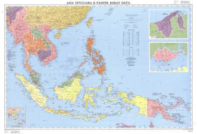
Peta Asia Tenggara & Pasifik Barat Daya (1:7 000 000) – No. Siri Rampaian 134
Pengenalan:
Peta ini menunjukkan kawasan negara-negara Asia Tenggara dan Asia Barat Daya.
Keterangan:
Maklumat-maklumat seperti jalan utama, keretapi dan ciri-ciri hidrografi ditunjukkan. Nama-nama negara, negeri, pulau-pulau dan nama ciri hidrografi ditunjukkan juga. Warna digunakan untuk membezakan antara satu negara dengan negara yang lain. Saiz format peta adalah 105 x 75 cm. Walaubagaimanapun maklumat-maklumat di peta ini tidak dikemaskini dan penerbitannya telah dihentikan. Penerbitan dan pengemaskinian peta ini telah diambilalih oleh pihak UNGEGN.
Jenis Peta:
Peta Malaysia (1:2 000 000) – No. Siri 1208
Pengenalan:
Peta siri ini telah digantikan dengan siri DNMM 1001.
Keterangan:
Ciri-ciri maklumat seperti sempadan antarabangsa, sempadan negeri, jalan utama, keretapi dan sungai utama, bandar, pekan dan kawasan penempatan ditunjukkan dengan simbol dan warna tertentu. Saiz format peta adalah 10350mm x 350mm.
Jenis Peta:
Peta Laporan Jalan Wilayah Persekutuan (1:10 000) – No. Siri Rampaian 82
Pengenalan:
Dalam Pembinaan.
Keterangan:
Tiada Maklumat
Jenis Peta:
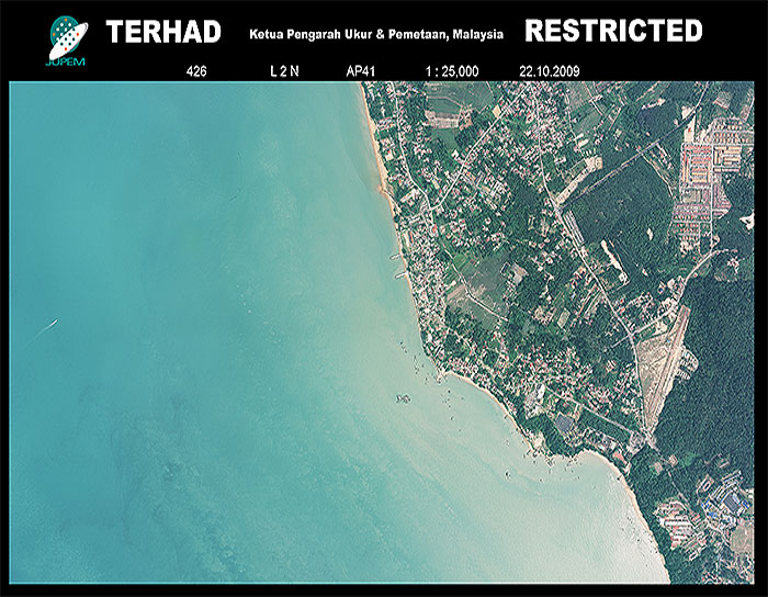
Foto Udara
Keterangan:
Berdasarkan larian gambar udara. Satu fotoudara yang diperolehi melalui kamera udara dalam proses pemetaan fotografi. JUPEM membekal gambar udara samada dalam bentuk salinan keras atau berdigit berdasarkan kamera udara analog dan digital. Fotoudara ini dikategorikan sebagai Dokumen Geospatial Terperingkat
Jenis Peta:
ORTOFOTO (SIRI MY701P(5K))
Keterangan:
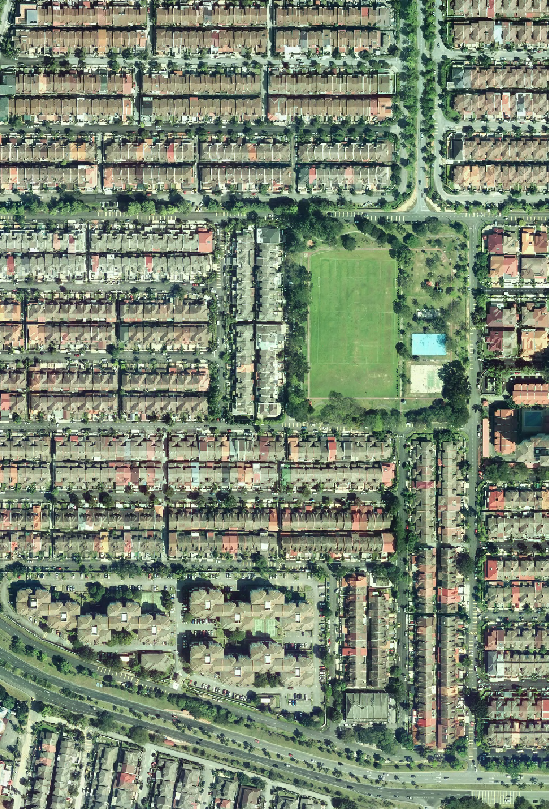
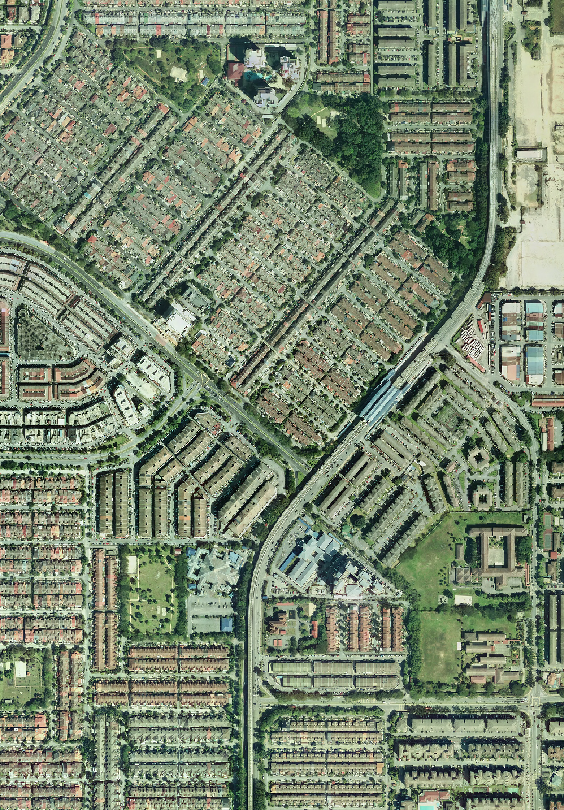
Gambar udara digital yang mana piksel geometri telah diperbetulkan dan diberi rujukan geografi. Merupakan struktur data raster. Ortofoto ini dikategorikan sebagai Dokumen Geospatial Terperingkat. Ortofoto ini disusun di atas Unjuran Bentuk Benar Serong Ditepati (Semenanjung Malaysia) Sferoid GRS 80, Datum 2000
Jenis Peta:
ORTOFOTO (SIRI MY701P(10K))
Keterangan:
Gambar udara digital yang mana piksel geometri telah diperbetulkan dan diberi rujukan geografi. Merupakan struktur data raster. Ortofoto ini dikategorikan sebagai Dokumen Geospatial Terperingkat. Ortofoto ini disusun di atas Unjuran Bentuk Benar Serong Ditepati (Semenanjung Malaysia) Sferoid GRS 80, Datum 2000
Jenis Peta:
ORTOFOTO (SIRI MY711P)
Keterangan:
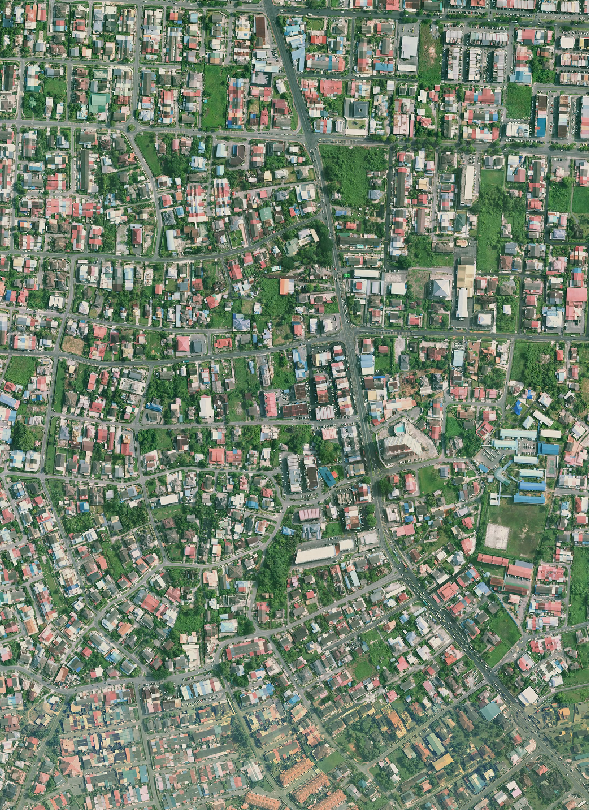
Gambar udara digital yang mana piksel geometri telah diperbetulkan dan diberi rujukan geografi. Merupakan struktur data raster. Ortofoto ini dikategorikan sebagai Dokumen Geospatial Terperingkat. Ortofoto ini disusun di atas Unjuran Bentuk Benar Serong Ditepati (Sabah, Sarawak dan Wilayah Persekutuan Labuan) Sferoid GRS 80, Datum 2000
| Item | Description |
|---|---|
| Map mounting services | |
| Map lamination with cloth | A process in which printed map is mounted with cloth or linen using gum. A piece of cloth or linen is gummed to the back of a map to further strengthen the map for handling and to make it suitable for hanging. |
| Map lamination | A process in which a map roller or a rounded piece of wood is fixed to the top as well as bottom of a map with cloth backing or a laminated map. The purpose of the rollers is to straighten the map when it is hang up for display. Sometimes, this piece of map is requested to be laminated too. |
| Other | |
| Fixing map roller | A process in which a map roller or a rounded piece of wood is fixed to the top as well as bottom of a map with cloth backing or a laminated map. The purpose of the rollers is to straighten the map when it is hang up for display. Sometimes, this piece of map is requested to be laminated too. |
Introduction:
Electronic maps or eMap are digital maps with the concept of multimedia cartography plug and play which can display spatial information and multimedia elements in a dynamic and interactive ways through the compact disc media (cd) and flash drive.
Information:
There are three (3) types of maps displayed in the Electronic Map State Map, District Map and Town Map. State and District maps are produced using a scale of 1: 25,000 while Town map is generated using a scale of 1: 10,000. The information contained in the electronic map presented in the form of graphics, virtual reality, text, video and audio. The Electronic map can be used for administration of the state affairs and tourism. This is because the border region, county, town and topographical details clearly shown on the map provided. As for tourism, the location and information on places of interest (VR) which is in a state are presented in the form of attractive graphics so that it can attract tourists to visit the location.
Peta Elektronik sesuai digunakan bagi urusan pentadbiran sesebuah negeri dan juga pelancongan. Ini adalah kerana sempadan daerah, mukim, bandar serta butiran topografi ditunjukkan dengan jelas dalam peta yang disediakan. Manakala bagi tujuan pelancongan, lokasi dan informasi tempat-tempat menarik (VR) yang terdapat dalam sesebuah negeri dipersembahkan dalam bentuk grafik yang menarik supaya ia dapat menarik minat pelancong untuk melawat ke lokasi tersebut.
Unjuran – Peta Elektronik telah disusun di atas Unjuran Bentuk Benar Serong Ditepati Sferoid GRS 80
Price per unit:
Electronic maps are sold in Compact Disc media (Edition 1 ) at a price of RM10 per unit and flash drive (Edition 2) at price of RM36.00 which include the medium storage.
Reference:
Projections – Electronic maps was compiled on the Rectified Skew Orthomorphic Projection GRS80 Spheroid.
Introduction:
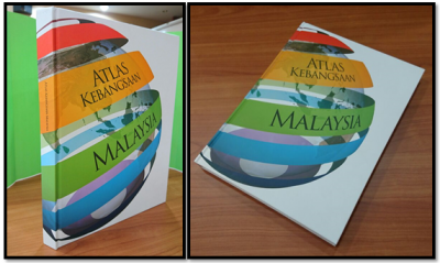
Atlas is a compilation maps showing comprehensive spatial data of a country and suitable to be a reference in the field of education, planning, scientific research and tourism. The information displayed is not limited to geographical information and infrastructure only but also include environmental, social conflict and so on.
Information:
National Atlas contains ten (10) main theme consists of Introduction, History, Border, Climate, Physical, Natural Resources, Land Use, Infrastructure and Public Utilities, Economics and Tourism. National Atlas consists of 260 pages and contains 10 themes and 56 sub-themes. National Atlas published in print and digital displays various type of maps, text, photos and statistical information for the theme of Identity, History, Border, Climate, Physical, Natural Resources, Land Use, Economics, Tourism and Infrastructure. National Atlas displays a collection of thematic maps option, text, photos and statistical information compiled an infographic and contemporary that makes this book even more interesting with the aim of increasing public interest to appreciate every aspect of the maps. National Atlas can also be used as reading material for the students, especially primary and lower secondary school. In addition, the information displayed and its preparation techniques are of interest to the students concerned to explore the field of geospatial and cartography.
Price per unit:
National Atlas priced at RM250 per copy.
Product Name:
Digital Cadastral Database (PDUK)
Product Description:
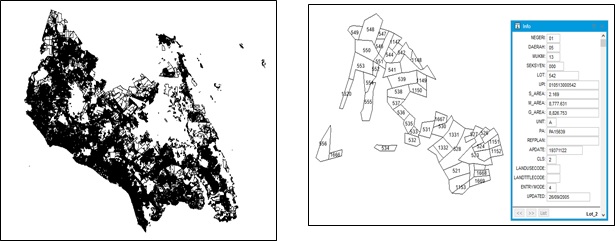
PDUK is a digital land surveying database known as Pangkalan Data Ukur Kadaster in Malay. The information shown in the database such as Unique Parcel Identifier (UPI), lot number, area and lot boundary information. The format that can be obtained is in vector graphical data format for example * .shp, * .tab, * .dxf, * .dgn and others. To this extent, the PDUK is no longer updated as JUPEM has used the new cadastral database system known as the National Digital Cadastral Survey Database (NDCDB) since 2009.
Coverage:
All States Survey and Mapping Department.
Price:
In accordance to Fees and Payments (Services, Survey and Mapping Data and Reproduction) Order 2010.
To purchase a product:
These products can be purchased from Customer Service Counter in JUPEM Headquarters or JUPEM States
Product name:
Certified Plan
Description:
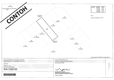
The Certified Plan (CP) is prepared after surveying have been carried out and approved by the Director of Survey and Mapping for the purpose of the issuance of a final title. The information shown are the Unique Parcel Identifier (UPI) information; State, District and District / subdivision, CP number, lot number, area, lot boundary information. CP are issued in various scales. The CP format that can be obtained is in the image file format for example * .JPEG *, .TIFF, * .MPMP and others.
Years of Observation:
Current
Coverage:
All States Survey and Mapping Department.
Price:
In accordance to Fees and Payments (Services, Survey and Mapping Data and Reproduction) Order 2010.
How to purchase the product:
These products can be purchased from Customer Service Counter in JUPEM Headquarters or JUPEM States or via e-Biz JUPEM Geoportal
Product name:
Certified Strata Plan
Description:
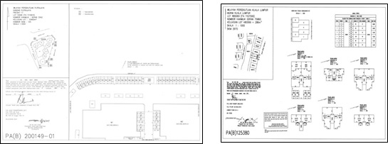
Certified Strata Plan is prepared according to the format specified by the Department. The features found in plan include location plan, storey plan, common boundary, number of parcels and share units. Information such as strata plan number, surveyed file number, Land Office file number and other particulars as prescribed by the Director of Survey and Mapping are also being displayed. Preparation of the Certified Strata Plan shall be based on the dimensions of the physical measurements of buildings that have been built on the site and in accordance with the building plans approved by the local planning authority. Digital format of the plan can be obtained from database can be obtained in the graphical format of the *.IFF raster data. The legal provisions are based on the Strata Titles Act 1985.
Years of Observation:
Current
Coverage:
All States Survey and Mapping Department
Price:
In accordance to Fees and Payments (Services, Survey and Mapping Data and Reproduction) Order 2010.
How to purchase the product:
These products can be purchased from Customer Service Counter in JUPEM Headquarters or JUPEM States
Product name:
Standard Sheet
Description:
The Standard Sheet is also known as the Cadastral Map. This is the result of a combined digital lots from the National Digital Cadastral Survey Database (NDCDB). The information shown such as Unique Parcel Identifier (UPI) information, State, District and Mukim / Section, the Certified Plan number and lot number are also displayed according to the suitability of its presentation. The Standard Sheet is in the Cassini Soldner projection and can be obtained in both digital and printed formats. The format available is in .shp, * .tab, * .dxf, * .dgn and * .EMF format.
Years of Observation:
Current
Coverage:
All States Survey and Mapping Department
Price:
In accordance to Fees and Payments (Services, Survey and Mapping Data and Reproduction) Order 2010.
How to purchase the product
Customer Service Counter in JUPEM Headquarters or JUPEM States or via E-Biz JUPEM Geoportal
Product:
Gazette Plan
Description:
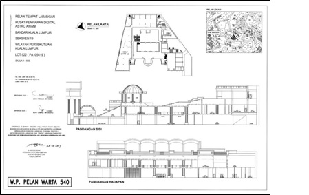
Gazette Plan is prepared by the Department and its showing specific boundaries or other spatial information as specified in the main gazette. Gazette Plan contains gazetted purposes, north indicator, scale, standard sheet number, related file number, administrative boundary, abuttal lot number, area, title number, name of Director of Survey and Mapping and gazette plan number. The format that can be obtained is in vector graphics data format for example * .shp, * .tab, * .dxf, * .dgn and others. The Gazette Plan is divided into several categories such as Protected Areas and Protected Places Plan, Delimitation of Constituencies Plan, the Alteration of the Boundary Plan and the Reserve Forest Gazetted Plan and others.
Years of observation:
Current
Coverage:
All state JUPEM.
Price:
-
How to purchase the product:
These products can be purchased from Customer Service Counter in JUPEM Headquarters or JUPEM States
Product Name:
GPS Station
Summary:
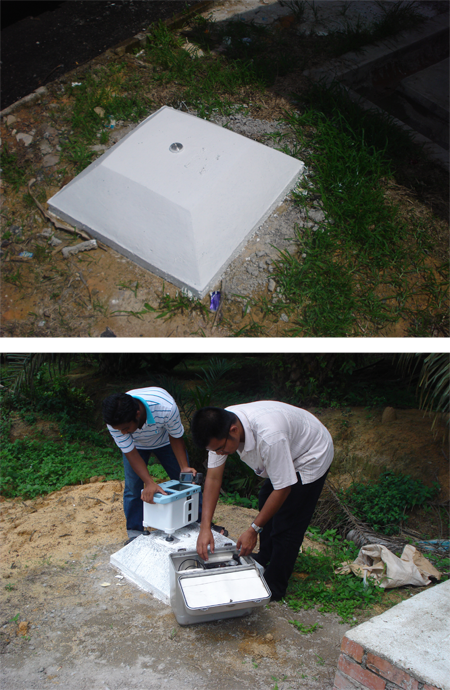
GPS Control Marks are marks that were set up to form a control network connected to the National Reference Frame of GDM2000 through the use of GPS measurement technique. These marks were chosen for use as control in cadastre surveys, mapping, military, scientific studies and etc.
Description:
Presently there are 238 GPS Control Marks established as the Peninsular Malaysia Primary GPS Network 2000 (PMPGN2000) and 171 GPS Control Marks established as the East Malaysia Primary GPS Network 2000 (EMPGN2000). The red G symbol is the purpose-made GPS monuments which has a plate and bolt, mounted on top of a concrete monument jutting out from the ground surface. Some of theses marks are re-used triangulation pillars or fundamental benchmarks. They have GPS coordinates of the same high quality, and are equally good for the purpose of controlling GPS surveys in the GDM2000 coordinate system. In addition to those shown on this map, new GPS control marks will be established in the future.
Years of Coverage:
1994 - 2000
Coverage:
238 Stations in Peninsular Malaysia
171 Stations in Sabah and Sarawak
Price:
MYR 15.00 per station.
How to purchase:
These products can be purchased from Geospatial Information and Sales Center or via E-Biz JUPEM Geoportal
Product Name:
Benchmark
Summary:
There are two types of benchmarks, namely Standard Benchmark (SBM) and Benchmark (BM).
Description:
There are two types of benchmarks:
Standard Benchmark (SBM)
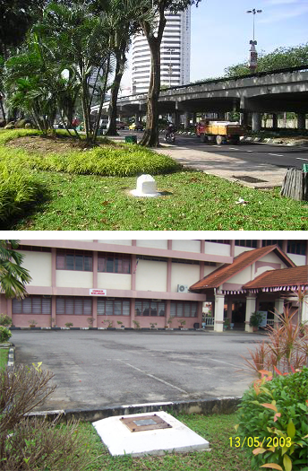
It is a ground planed monument built for stability to minimised the probability of disturbance. The SBM are established within the precise leveling network to provide a stable benchmark system that will control the leveling network. The marks are located along major road system at road junctions or at every 40 kilometers intervals.
Benchmark (BM)
It is built between standard benchmarks at every half (0.5) kilometer in developed area and at every one (1) kilometer for the rest. Each benchmark has a plate and bolt, mounted on top of a concrete monument jutting out from the ground surface and they are located near or within permanent structures such as milestones, bridges, telecommunication poles and buildings (police station, school etc).
Years of observation:
Every year
Liputan:
Along major roads in Peninsular Malaysia.
Price:
MYR 5.00 per station.
How to purchase:
These products can be purchased from Geospatial Information and Sales Center or via E-Biz JUPEM Geoportal
Product Name:
Graviti Data
Summary:
Gravity data observed by JUPEM has two main purposes: To calculate the gravimetric correction in orthometric heighting for the precise leveling network. To calculate the local geoid and produce gravimetric geoid model.
Description:
- The accuracy of First Order Gravity Network is 0.03 mGal. These data are measured using high precision relative gravimeter along the precise leveling route at intervals of 40-50 km for the area that MSL is below 100m and 10-20km for the area that MSL is above 100m. The Network is based on the absolute gravity value of IGSN71 (International Gravity Standardization Net 1971) station at University of Malaya and absolute station at JUPEM Headquarter.
- The accuracy of Second Order Gravity Network is 0.05 mGal. These data are also measured using high precision relative gravimeter along the precise leveling route at intervals of 1-5 km and referred to First Class Order Gravity Network.
- The accuracy of Third Order Gravity Network is 0.1 mGal. These data are measured on 5-10 km grid, which referred to Second Order Gravity Network.
Tahun Cerapan:
Setiap Tahun
Liputan:
Laluan utama jalan raya Malaysia (Semenanjung Malaysia, Sabah dan Sarawak)
Harga Belian:
RM 12.00 setiap stesen.
Cara Mendapatkan Produk:
Boleh diperolehi dari Pusat-Pusat Maklumat dan Jualan Data Geospatial JUPEM di seluruh negara atau secara atas talian mela E-Biz JUPEM Geoportal
Product Name:
MyGeoid Map
Summary:
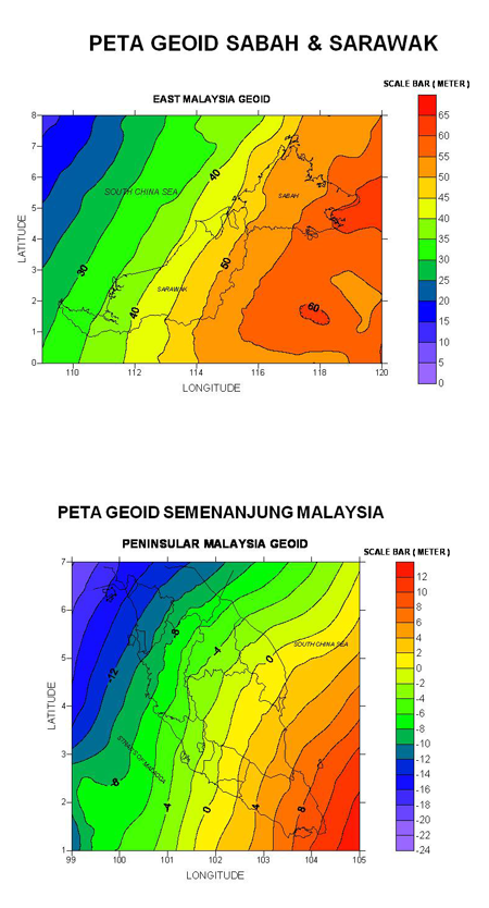
Malaysian Geoid Models, MyGEOID consists of two basic models namely WMGEOID04 in Peninsular Malaysia and EMGEOID05 in Sabah and Sarawak. MyGEOID could be supplied in L7030 or T738 topographic map size. These geoid models are hybrid of gravimetric geoids with GPS ellipsoid heights on leveled bench marks. Therefore, these values are suitable for use with GPS survey to obtain mean sea level directly without further transformation.
Description:
- MyGEOID can divide in to two::
- Separate Geoid Map in the size of Peninsular Malaysia, Sabah and Sarawak, Sabah or Sarawak.
- Geoid Map in the size of topograpgy map (30km X 30km) L7030 0r T736
Years of Observation:
2004/2005
Coverate:
Malaysia.
10 km dari garisan pesisir pantai Malaysia.
Price:
- Height of Geoid : MRY3.00 per point
- One map sheet 30kmx30km : MRY250.00 per sheet
- Peninsular Malaysia : MRY20,000.00 per set
- Sabah : MRY10,000.00 per set
- Sarawak : MRY10,000.00 per set
- Federal Territory of Labuan : MRY250.00 per set
Information Needed When Applying the Data
- For a single point:
- Station id/latitude/longitude/height (Ellipsoidal/MSL) – (degrees decimal)
- Station id/latitude/longitude/height (Ellipsoidal/MSL) – (degree, minutes, second)
- Station id / X / Y / Z (meter)
- Station id / N / E / Height (General UTM in meter)
*Kedua-dua maklumat tersebut diperolehi dari cerapan GNSS di lapangan.
- For one map sheet (30km x 30km):
- Center coordinates of selected area (WGS84)
How to purchase:
Bagi model-model MyGeoid sedia ada, ia boleh diperolehi secara atas talian melalui E-Biz JUPEM Geoportal manakala permohonan transformasi ketinggian menggunakan MyGeoid dan penyediaan lembar geoid pilihan, pemohon boleh menghubungi Seksyen Graviti dan Falak, Bahagian Ukur Geodetik, JUPEM.
Product Name:
Tidal Data
Summary:
JUPEM has published information on tide for 12 locations at Peninsular Malaysia, 6 locations in Sabah and 4 locations in Sarawak. These data is available in printed or digital (.pdf format) version.
Description:
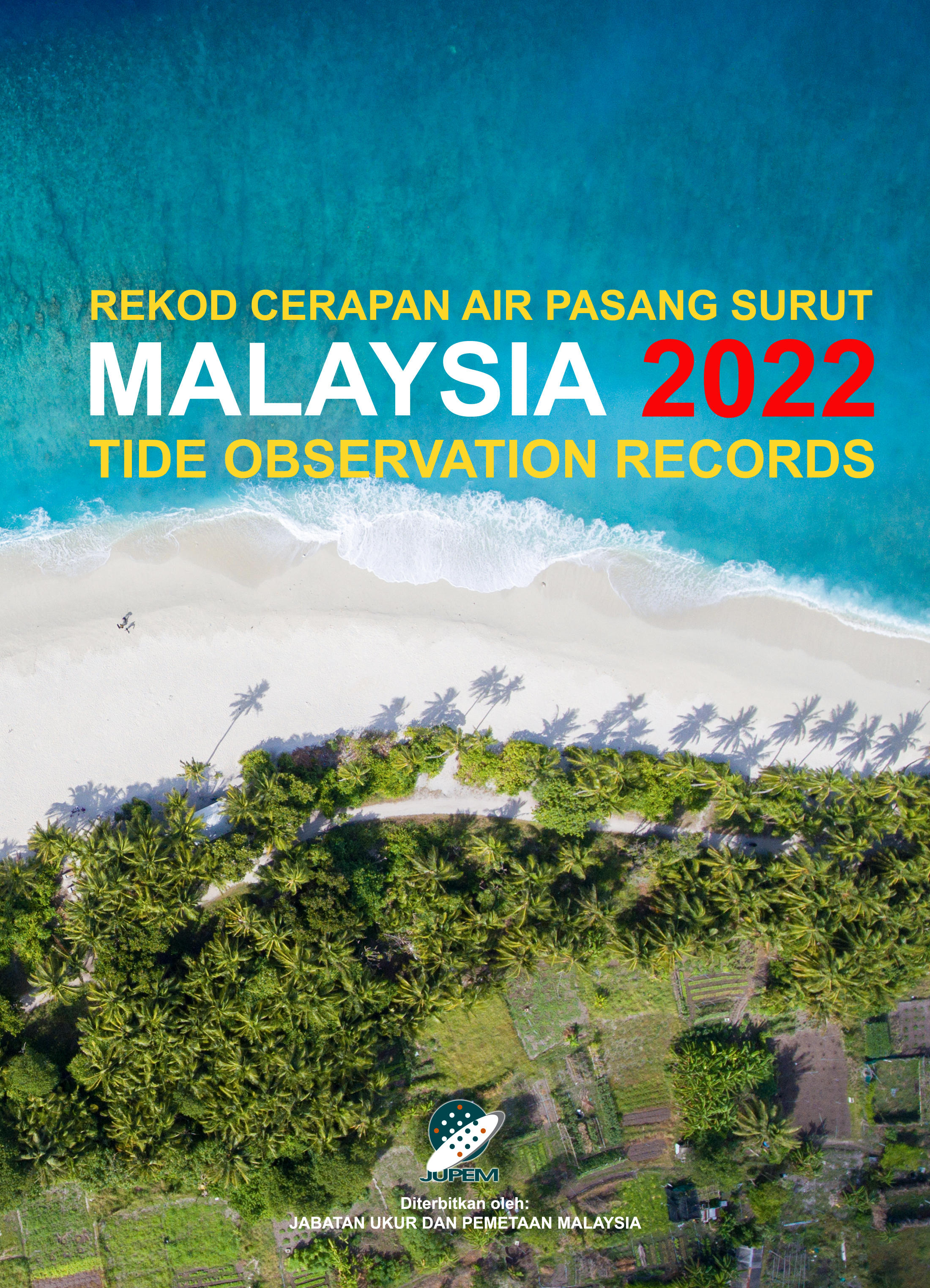
Tide Observation Record is published annually that contains information about station location, tide level, mean sea level and harmonic constant. In addition, there is also detailed information on each tide gauge stations, the data level and sea level changes marigram. Tide Tables annual data is generated from observations through the analysis of harmonic calculation. A datum level is used for predictions based on the Indian Spring Low Water (ISLW) tides. Tide Tables contain the following information :
- Harmonic Constant
- Table of Hourly Heights
- Table of Times and Heights of High and Low Waters
- Tidal Marigram
Years of Coverage:
Every year
Coverage:
Malaysia
Price:
- Tidal Data : MYR5.00 per month per station
- Tidal Observation Record : MRY50.00 per volume
- Tidal Prediction Table : MRY50.00 per volume
Cara Mendapatkan Produk:
Boleh diperolehi dari Pusat-Pusat Maklumat dan Jualan Data Geospatial JUPEM di seluruh negara atau secara atas talian melalui E-Biz JUPEM Geoportal.
Jadual Air Pasang Surut:
Product Name:
Coordinate Transformation Parameter.
Summary:
Coordinate Transformation is the process of changing of coordinate system or datum from one system to another for the purpose of its usage on different application and base map. DSMM has produced various sets of transformation parameter to relate the different types of coordinate systems in Malaysia.
Description:
The transformation parameter were generated based on coordinates of some well chosen control stations which are common to different datums. They are generated through least square analysis using various models accepted by the global geodetic community. There are fourteen (14) sets of transformation parameter available at DSMM:
- GDM2000 to GDM2000 (2008)
- GDM2000 to EMGSN97
- GDM2000 to MRT48
- GDM2000 to MRT48
- GDM2000 to BT68 (Sarawak)
- GDM2000 to MRSOGDM
- GDM2000 to BRSOGDM
- GDM2000 to CassiniGDM
- PMGSN94 to MRT48
- EMGSN97 to BT68 (Sabah)
- EMGSN97 to BT68 (Sarawak)
- MRT48 to MRSO
- BT68 to BRSO
- MRSO to Cassini
Years of Coverage:
2005
Coverage:
Malaysia
Price:
- Coordinate Transformation : MYR4.00 per station
- Coordinate Transformation Parameter : MRY60.00 one set
Cara Mendapatkan Produk:
Boleh diperolehi dari Pusat-Pusat Maklumat dan Jualan Data Geospatial JUPEM di seluruh negara atau secara atas talian melalui E-Biz JUPEM Geoportal.
Product Name:
Coordinate Transformation.
Summary:
Coordinate Transformation is the process of changing of coordinate system or datum from one system to another for the purpose of its usage on different application and base map. DSMM has produced various sets of transformation parameter to relate the different types of coordinate systems in Malaysia.
Description:
Coordinate transformation services for the following could be performed for clients:
- GDM2000 to PMGSN94
- GDM2000 to EMGSN97
- GDM2000 to MRT48
- GDM2000 to BT68 (Sabah)
- GDM2000 to BT68 (Sarawak)
- GDM2000 to MRSOGDM
- GDM2000 to BRSOGDM
- GDM2000 to CassiniGDM
- PMGSN94 to MRT48
- EMGSN97to BT68 (Sabah)
- EMGSN97 to BT68 (Sarawak)
- MRT48 to MRSO
- BT68 to BRSO
- MRSO to Cassini
Years of Coverage:
2005
Coverage:
Malaysia
Price:
RM 4.00 per station.
Cara Mendapatkan Produk:
Boleh diperolehi dari Pusat Khidmat Pelanggan Ibu Pejabat JUPEM atau JUPEM Negeri atau secara atas talian melalui E-Biz JUPEM Geoportal
Product Name:
Geiodal Height Computation.
Summary:
Malaysian Geoid Models, MyGEOID consists of two basic models namely WMGEOID04 in Peninsular Malaysia and EMGEOID05 in Sabah and Sarawak. They are the first national geoid models produced by JUPEM through its joint consultancy with KMS of Denmark in the Airborne Gravity Survey and Geoid Determination Project. These geoid models are hybrid of gravimetric geoids with GPS ellipsoid heights on leveled bench marks. Therefore, these values are suitable for use with GPS survey to obtain mean sea level directly without further transformation.
Description:
MyGeoid2 is obtained from downward continued free-air gravity grid at zero level by spherical FFT, followed by the restore of the spherical harmonic and RTM geoid effects. It uses the latest available terrestrial and airborne data with a total of 960 x 1080 points in Peninsular Malaysia and 1080 x 1680 points in Sabah and Sarawak. WMGEOID04 and EMGEOID05 consist of a 1′ by 1′ grid (approximately 1.8km) of geoid-ellipsoid separations (N Values) relative to the Local Mean Sea Level. The Geoid Height Computation service is provided for user to key in the WGS84 coordinates of points interactively for the geoid heights required. Batch processing is also available, and for this service, the user would need to load in the input file concerned based on the required format.
Years of Observation:
2004/2005
Coverage:
Malaysia
10 km dari garisan pesisir pantai Malaysia
Harga Belian:
MYR 3.00 per point.
To purchase the product:
Bagi transformasi hitungan ketinggian menggunakan MyGeoid ini, pengguna boleh menggunakan aplikasi secara interaktif secara atas talian di dalam E-Biz JUPEM Geoportal. Sekiranya menghadapi masalah untuk menggunakan aplikasi tersebut, pemohon boleh menghubungi Seksyen Graviti dan Falak, Bahagian Ukur Geodetik, JUPEM bagi mendapatkan perkhidmatan tersebut.
Product Name:
MYRTK Data
Summary:
MyRTKnet is the infrastructure that has been formed by the Global Navigation Satellite System (GNSS) reference stations and Control Centre to provide the GNSS data in order to give the position in real time. MyRTKnet service has been developed in 2003 that consist of 27 GNSS reference stations throughout the country. In endeavor to give a better service to the user, another 51 GNSS reference stations have been established by Department of Survey and Mapping Malaysia (DSMM) in 2006 until 2008 and the total number of reference stations now are 78 stations.
Description:
50 GNSS reference stations are located in Peninsular Malaysia whilst 28 stations in Sabah and Sarawak. The distance between the stations is from 30 to 150 km. The stations track GNSS signals and send them via dedicated data lines to a central network server at DSMM Geodesy Section, which manages and distributes GNSS correction data to subscribers in real time. Right now, the centimeter accuracy can be achieved to all users in Peninsular Malaysia, Kuching (Sarawak) and Kota Kinabalu (Sabah). The user also can get the DGPS correction anywhere in Malaysia as long as the telecommunications coverage is there.
The MyRTKnet service provides the data as stated in table below. The data that have been supplied to the user comprising of real time and post-processed data depend on the objective of work. The post-processed data consist of RINEX and Virtual RINEX data. The data can be downloaded via DSMM website in interval from 0.1 to 60 seconds. In order to get a good result, user should follow the Director General Circular No. 9/2005 which can be viewed in DSMM website.
MyRTKnet Services:
| # | Data Type | Data Feature |
|---|---|---|
| 1 | Virtual Reference Station (VRS) Correction | Real Time |
| 2 | Single Base Correction | Real Time |
| 3 | Network Base DGPS Correction | Real Time |
Years of Coverage:
Every year
Coverage:
Malaysia
Harga Belian:
| # | JENIS DATA | HARGA BELIAN |
|---|---|---|
| 1 | Pembetulan Cerapan Masa Hakiki (VRS, iMAX, MAC, NB, SB, FKP dan DGSP) | RM1,000.00 setiap pengguna bagi setahun |
| 2 | Data pasca-proses VRS GPS RINEX | RM 1.00 setiap minit bagi setiap stesen |
| 3 | Data pasca-proses Stesen Rujukan GPS | RM 2.00 setiap jam bagi setiap stesen |
Cara Mendapatkan Produk:
Boleh diperolehi dari Pusat-Pusat Maklumat dan Jualan Data Geospatial JUPEM di seluruh negara atau secara atas talian mela E-Biz JUPEM Geoportal
| Title | Date Published |
|---|---|
|
Malaysia tambah aset di Beting Patinggi Ali |
2023-01-26 |
|
Wartakan wilayah Sabah, Sarawak |
2023-01-25 |
|
Malaysia, Singapura terus perkukuh hubungan erat |
2023-01-16 |
|
'PM jamin selesai isu tertunggak Malaysia-Singapura' |
2022-01-30 |
|
6 pusat data jimatkan kos elektrik kerajaan RM4.1 juta setahun |
2021-12-13 |
|
Six govt agencies win Green Computing Awards for energy efficiency |
2021-12-13 |
|
Bayaran daftar baharu, pembaharuan MyRTKnet dikurang 50 peratus |
2021-10-11 |
|
SUDAH ADA "PARUT" |
2021-09-11 |
|
Sungai bengkok jadi lurus kesan kepala air |
2021-09-11 |
|
JUPEM lakukan pemetaan semula Gunung Jerai |
2021-09-09 |
| No. Siri Perolehan | Tajuk Perolehan | Syarikat | Nilai |
|---|---|---|---|
| JUPEM T3/2022 | KAJIAN PELAKSANAAN PENGUKURAN STRATUM DAN SPATIUM SERTA KAJIAN KES MELALUI PELANTIKAN PERUNDING UNTUK BAHAGIAN KADASTER, JABATAN UKUR DAN PEMETAAN MALAYSIA (JUPEM), KEMENTERIAN TENAGA DAN SUMBER ASLI (KETSA) | SN SURVEY CONSULTANTS | RM 1,147,789.20 |
| JUPEM T1/2022 | PEROLEHAN MEMBEKAL, MENGHANTAR, MEMASANG, MENGUJI DAN MENTAULIAH UNMANNED AERIAL SYSTEM (UAS) BERSERTA PERALATAN SOKONGAN BAGI AKTIVITI PEMETAAN DI BAWAH PROJEK MENAIK TARAF e-PEMETAAN, JABATAN UKUR DAN PEMETAAN MALAYSIA (JUPEM), KEMENTERIAN TENAGA DAN SUMBER ASLI (KeTSA) - T1/2022 | SKY - SHINE CORPORATION (M) SDN. BHD. | RM 7,672,458.00 |
| JUPEM T2/2022 | PEROLEHAN MEMBEKAL, MENGHANTAR, MENGUJI DAN MENTAULIAH EMPAT BELAS (14) SET ALAT PENERIMA GLOBAL NAVIGATION SATELLITE SYSTEM (GNSS) UNTUK JABATAN UKUR DAN PEMETAAN MALAYSIA (JUPEM), KEMENTERIAN TENAGA DAN SUMBER ASLI (KeTSA) - T2/2022 | GEOPIXEL SDN. BHD. | RM 1,726,760.00 |
| JUPEM T20/2021 | PEROLEHAN PERKHIDMATAN HELIKOPTER UNTUK PENANDAAN, PENGUKURAN DAN PENYELENGGARAAN SEMPADAN BERSAMA ANTARA NEGERI-NEGERI DI SEMENANJUNG MALAYSIA BAGI JABATAN UKUR DAN PEMETAAN MALAYSIA (JUPEM), KEMENTERIAN TENAGA DAN SUMBER ASLI (KeTSA) - T20/2021 | SYSTEMATIC AVIATION SERVICES SDN. BHD. | RM 3,553,840.80 |
| JUPEM T4/2022 | PEROLEHAN PERKHIDMATAN PENGEKSTRAKAN FITUR DATA TOPOGRAFI BERSKALA 1:5000 SECARA AUTOMATIK BAGI PEMETAAN PETA BANDAR FASA III ZON 2 UNTUK BAHAGIAN PEMETAAN TOPOGRAFI SEMENANJUNG, JABATAN UKUR DAN PEMETAAN MALAYSIA (JUPEM), KEMENTERIAN TENAGA DAN SUMBER ASLI (KeTSA) - T4/2022 | TEKNOLOGI KBSE SDN. BHD. | RM 2,824,582.00 |
| No. Siri Perolehan | Tajuk Perolehan | Syarikat | Nilai |
|---|---|---|---|
| JUPEM SHB1/2021 | PEROLEHAN MEMBEKAL DAN MENGHANTAR ALAT TULIS UNTUK STOR UTAMA IBU PEJABAT JABATAN UKUR DAN PEMETAAN MALAYSIA (JUPEM), KEMENTERIAN TENAGA DAN SUMBER ASLI (KeTSA) - SHB1/2021 PEMBEKAL BERJAYA | UNITED STATIONERY CO. (M) SDN. BHD. | RM 44,183.50 |
| JUPEM SHB2/2021 | PEROLEHAN PERKHIDMATAN AUDIT PENSIJILAN SEMULA MS ISO 9001:2015 JABATAN UKUR DAN PEMETAAN MALAYSIA (JUPEM), KEMENTERIAN TENAGA DAN SUMBER ASLI (KeTSA) - SHB2/2021 | SIRIM QAS INTERNATIONAL SDN. BHD. | RM 37,296.00 |
| JUPEM SH14/2021 | PEROLEHAN PERKHIDMATAN PENYEWAAN PENYAMAN UDARA DI IBU PEJABAT JABATAN UKUR DAN PEMETAAN MALAYSIA (JUPEM), KEMENTERIAN TENAGA DAN SUMBER ASLI (KeTSA) - SH14/2021 | MTZ SDN. BHD. | RM 472,420.80 |
APAKAH JENIS PRODUK PEMETAAN DIGITAL JUPEM
Tempoh masa: 2:09
Tarikh: 05-07-2024
CREATE FEATURE TOOLS DAN SPLIT TOOLS
Tempoh masa: 2:26
Tarikh: 28-06-2024
PROSES MENGIMPORT IMAGERY
Tempoh masa: 2:03
Tarikh: 10-06-2024
DATABASE CONNECTION DAN LABELLING PROPERTIES
Tempoh masa: 2:41
Tarikh: 28-05-2024
SAMBUTAN HARI RAYA AIDILFITRI @ JUPEM 2024
Tempoh masa: 12:02
Tarikh: 02-05-2024
MONTAJ GSD 2024
Tempoh masa: 1:49
Tarikh: 18-04-2024
MAJLIS KHATAM AL-QURAN IHYA' RAMADHAN 1445H JUPEM IBU PEJABAT | 03 APRIL 2024
Tempoh masa: 2:17
Tarikh: 18-04-2024
PEMETAAN UDARA_UAS
Tempoh masa: 1:01
Tarikh: 15-04-2024
PEMETAAN UTILITI BAWAH TANAH | JUPEM P.PINANG
Tempoh masa: 1:01
Tarikh: 15-04-2024
TAKBIR RAYA JUPEM 2024
Tempoh masa: 5:01
Tarikh: 09-04-2024
Alaaa... mak nak balik raya
Tempoh masa: 2:33
Tarikh: 09-04-2024
RANGKUMAN AKTIVITI JUPEM TAHUN 2023
Tempoh masa: 4:50
Tarikh: 04-03-2024
BUKU 'DIARI 100 HARI KPUP'
Tempoh masa: 2:03
Tarikh: 04-03-2024
KEBAWAH DULI YANG DIPERTUAN AGONG BERKENAN UNTUK MERASMIKAN TEMERLOH TITIK TENGAH SEMENANJUNG (T3S)
Tempoh masa: 2:03
Tarikh: 23-01-2024
VIDEO @ CARA PERMOHONAN LESEN DATA DIGITAL DALAM SISTEM EBIZ
Tempoh masa: 2:05
Tarikh: 09-01-2024
Tragedi UKUR
Tempoh masa: 2:05
Tarikh: 09-01-2024
Tragedi UKUR
Tempoh masa: 1:33
Tarikh: 11-12-2023
PROJEK KHAS PENGGAMBARAN UDARA PERSEMPADANAN MALAYSIA-INDONESIA (PULAU SEBATIK)
Tempoh masa: 2:37
Tarikh: 1-12-2023
MyKIBLAT: Dimana-mana...
Tempoh masa: 1:01
Tarikh: 27-11-2023
TAPAK UJIAN GNSS @ N.SEMBILAN
Tempoh masa: 3:35
Tarikh: 30-10-2023
PRINTING FOR THE NATION : TEKNOLOGI PERCETAKAN BERASASKAN IR4.0 @ JUPEM
Tempoh masa: 3:01
Tarikh: 20-10-2023
VIDEO PROMOSI MyKIBLAT JUPEM OLEH BEP
Tempoh masa: 1:45
Tarikh: 06-10-2023
KONTIJEN JUPEM PERARAKAN MAULIDUR RASUL SAW PERINGKAT KEBANGSAAN TAHUN 1445H/2023
Tempoh masa: 1:52
Tarikh: 06-10-2023
Video @ Ukur : Imbasan Tahun 2022
Tempoh masa: 2:59
Tarikh: 13-02-2023
Video Rangkuman Bencana Tanah Runtuh Di Batang Kali Selangor
Tempoh masa: 3:05
Tarikh: 13-02-2023
Berita@Ukur : Januari 2023 -Video Rangkuman
Tempoh masa: 3:07
Tarikh: 02-02-2023
Taklimat Status Penandaan dan Pengukuran Sempadan Negeri Kedah-Perlis kepada Ahli MMK Negeri Kedah
Tempoh masa: 1:39
Tarikh: 20-01-2023
Sesi Menandatangani Pelan Kerja Projek Penandaan & Pengukuran Sempadan Bersama Antara Kedah & Perlis
Tempoh masa: 2:03
Tarikh: 04-10-2022
Rangkuman Video: Program Kesihatan ‘Health Talk’ Oleh Pakar Kesihatan, Dr. Robert H.Lustig
Tempoh masa: 1:22
Tarikh: 05-12-2022
JUPEM @ Karnival Youth Career Peringkat Kebangsaan-Dialog Forum & Pameran | 28 Oktober 2022
Tempoh masa: 4:35
Tarikh: 28-10-2022
Cabaran Membina Landing Pad_Sempadan Perak & Kelantan
Tempoh masa: 4:15
Tarikh: 08-11-2022
Lawatan Teknikal Ke Pulau Payar
Tempoh masa: 2:03
Tarikh: 06-10-2022
Sesi Menandatangani Pelan Kerja Projek Penandaan & Pengukuran Sempadan Bersama Antara Kedah & Perlis
Tempoh masa: 2:03
Tarikh: 04-10-2022
Rangkuman Konvensyen Horizon Baharu Kumpulan Inovatif Dan Kreatif (KIK) JUPEM 2022
Tempoh masa: 4:14
Tarikh: 20-09-2022
Montaj Kumpulan KIK JUPEM Pahang_Gading
Tempoh masa: 3:00
Tarikh: 19-09-2022
Montaj Kumpulan KIK JUPEM Johor_Prestij_SMD
Tempoh masa: 3:01
Tarikh: 08-09-2022
Montaj Kumpulan KIK BPT Sarawak_The Swan
Tempoh masa: 3:32
Tarikh: 08-09-2022
Montaj Kumpulan KIK JUPEM Terengganu_ICT
Tempoh masa: 2:28
Tarikh: 08-09-2022
Montaj Kumpulan KIK JUPEM Selangor_ Iltizam
Tempoh masa: 1:39
Tarikh: 08-09-2022
Montaj Kumpulan KIK JUPEM Pulau Pinang_Miracle Sparkle
Tempoh masa: 2:48
Tarikh: 08-09-2022
Video Korporat JUPEM
Tempoh masa: 9:10
Tarikh: 03-04-2018
From Borders to Boundaries – The JUPEM Story
Tempoh masa: 9:10
Tarikh: 03-04-2018
| Produk | January | February | March | April | May | June | July | August | September | October | November | December | Total |
|---|---|---|---|---|---|---|---|---|---|---|---|---|---|
| Cadaster | 8479 | 9114 | 11285 | 7918 | 10647 | 11150 | 10901 | 11584 | 10285 | 11772 | 10664 | 8923 | 122722 |
| Mapping | 42 | 90 | 60 | 30 | 25 | 121 | 63 | 75 | 62 | 50 | 121 | 26 | 765 |
| Geodesic | 616 | 615 | 697 | 519 | 614 | 709 | 769 | 889 | 835 | 819 | 731 | 600 | 8413 |
| Application for Digital License | 85 | 84 | 113 | 70 | 103 | 78 | 84 | 113 | 108 | 91 | 89 | 46 | 1064 |
| MyRTKnet System | 21 | 27 | 27 | 11 | 16 | 16 | 14 | 21 | 14 | 22 | 29 | 39 | 257 |
| Geodetik Services | 51 | 90 | 153 | 47 | 176 | 108 | 125 | 193 | 136 | 83 | 90 | 76 | 1328 |
| Limited Data Application | 3 | 5 | 3 | - | 6 | 2 | 2 | 5 | 2 | 8 | 7 | 4 | 47 |
| Permit Application | 61 | 54 | 61 | 72 | 123 | 101 | 141 | 118 | 107 | 100 | 90 | 47 | 1075 |
| Monthly Total | 8615 | 9290 | 11529 | 8048 | 10968 | 11377 | 11183 | 11921 | 10544 | 11985 | 10880 | 9089 | 125429 |
Open Government’s Data is a group of data that can be used independently, shared and reuse by the people, government and private agencies for various purposes.
The goal of this initiative is to increase the transparency of government service delivery through accurate, timely and relevant shared data. In addition, the implementation of open government’s data can also improve the productivity country digital economy through new innovations to the industry or the involvement of citizens and business community.
The use or re-use of data shall abide to the terms and conditions: Terms Of Use Open Goverment’s Data 1.0
For more information, please visit Malaysia’s Open Data Official Portal







.png)











-1713760243.png)
-1713754486.png)


